| N18°51.34 E98°57.60 | Don Kaeo (burial area) (Th: ดอนแก้ว / Jp: ドンケオ略図 ) page 2 of 3 |
Route 0107 |
| Text | Notes | ||||
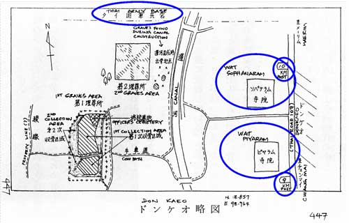
| Maps of Don Kaeo burial area: To supplement the descriptions, the book provides a map:[9]
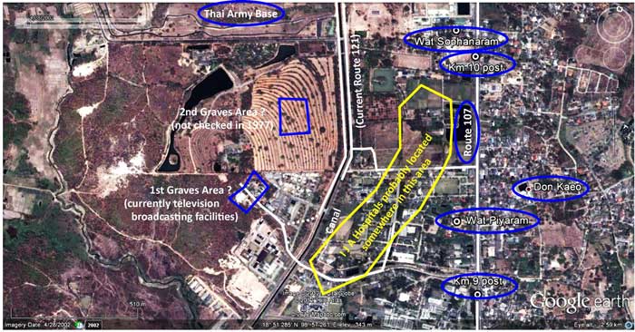
Sufficient details visible on a Google Earth view of the area[10] (called out with blue circles and white-colored notes) seem to fairly well locate the Journal map above: Note the area marked with yellow: while the Journal map does not call this out, the hospitals can be generally located by the description that the burial areas were half a kilometer to the west of the hospitals. |
|||||
|
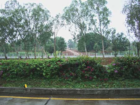
Photos of locations described in the Journal on Collection of War Dead's presentation about the Don Kaeo burial area: On the ground (N18°51.43 E98°57.73), looking west from Route 121 across the khlong at the general area of the grave sites:[11]
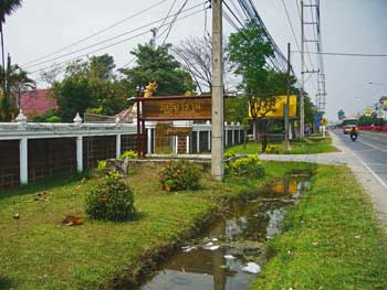
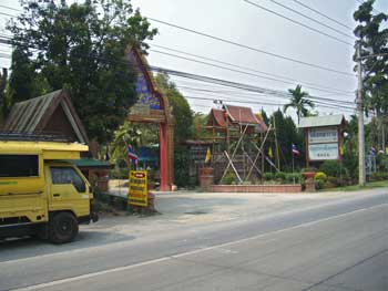
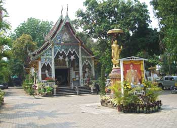
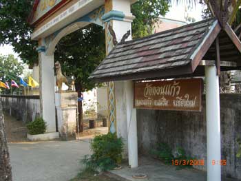
Wat Piyaram, N18°51.32 E98°58.06, on Thai Route 107 at Station 9+300 Entrance on Thai Route 107:[13]
Entrance on Thai Route 107:[15]
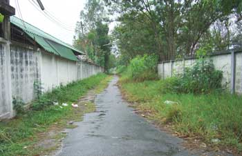
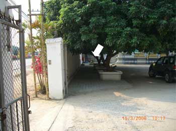
In between the two wats are several lanes heading west from Route 107. One more likely than others to have been that shown in the Journal map is this one at 107:09+500, N18°51.435 E98°58.020:[16a]
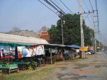
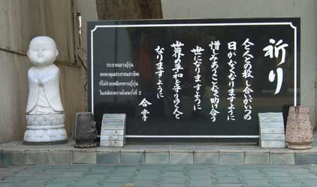
Other items relevant to the Don Kaeo site: The Journal does not mention a small Japanese memorial at a wat about four kilometers further north on Thai Route 107: Wat Sawang Ban Thoeng, N18°53.54 E98°57.17, at 107: 13+800. No doubt it was dedicated long after the Journal was completed. The approach to the wat entrance is obscured by a roadside market; however the wat rooftops are still visible beyond:[17]
The memorial is in the form of a freestanding tablet:[19]
The Japanese text reads:
The Thai text reads:
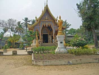
In addition, for clarification, it is noted that there is a Wat Don Kaeo at N18°52.79 E98°58.32, about one kilometer east of the kilometer post 12 on Thai Route 107:[20]
Located about 2.5 kilometers northeast of the Don Kaeo burial site, It does not appear to have been related to IJA activities at Don Kaeo during the war.
|
9.^ ibid, p 447 10.^ Google Earth view of site, approximate center of photo: N18°51.35 E98°57.72 with an eye altitude of 2.59 km. If the aerial view is correct, approximate centers of Graves Areas are:
12.^ Read location as: On Thai Route 0107 (the Chiang Mai - Mae Rim Road), pass kilometer marker for "9" (kilometers) --- it is a white concrete monument located in the median --- and go about 300 meters farther: entrance to Wat Piyaram will be at this point. 13.^ CIMG2865.jpg 14.^ CIMG2864.jpg
15.^ CIMG2867.jpg
16.^ CIMG2868a.jpg
16a.^ CIMG3236.jpg
17.^ CIMG2885.jpg
18.^ CIMG2886-markup.jpg
19.^ CIMG2888.jpg
20.^ CIMG2881.jpg |
||||