| N18°46.63 E98°59.10 | Wat Muen San (Th: วัด หี่มนสาร / Jp: ワツトムンサーン ) Supplemental page |
Route 0108a |
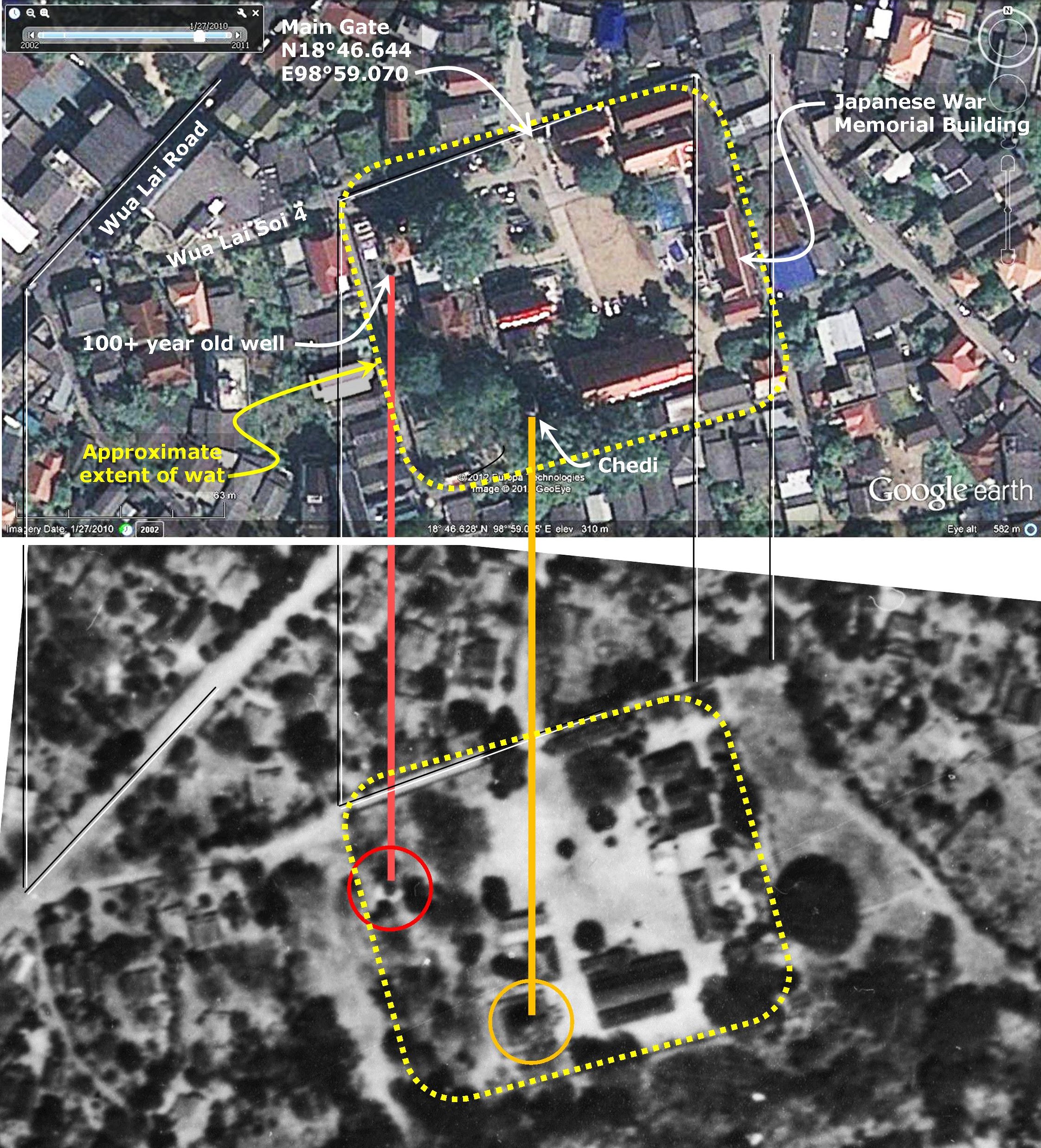
A higher resolution view of a comparison of 1944 and 2009 aerial photos of Wat Muen San[1]
Notes
1.^The first image above is from Google Earth dated 27 Jan 2010 and accessed 29 Jul 2012. The second image is an extract from 02486.jpg, taken 03 Apr 1944 by the RAF; source: Williams-Hunt Aerial Photos Collection; original from the School of Oriental and African Studies (SOAS), University of London Digital Data from Center for Southeast Asia Studies (CSEAS), Kyoto University; Digital Archive from Chulachomklao Royal Military Academy (CRMA), Thailand.
Extraneous lines and circles link key features, common to both images, for alignment purposes.
Annotations are by author.
| First published on Internet | ||