| N 18° 49.316 E 97° 55.791 |
Khun Yuam Airstrip (Th: ท่าอากาศยานขุนยวม / Jp: クンユアム滑走路 ) page 2 of 2 |
Route 0108b Station 197 |
|
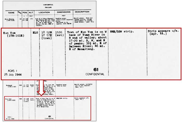
In July 1944, more details were provided, including classification of the Khun Yuam runway as an "ELG", or Emergency Landing Ground. It was, however, described as "u/s", unserviceable.:[14]
| ||
| Text | Notes | |
|
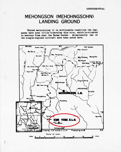
In the December 1944 Allied intel report, Khun Yuam is presented as equal in prominence to Mae Hong Son --- at least in font size:[14a]
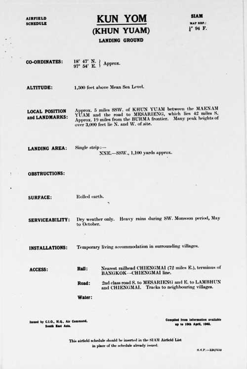
A more formal intel report writeup on Khun Yuam appears in April 1945:[15]
This more sophisticated report may well have been a function not of the perceived growing importance of the Khun Yuam ELG, but rather of the growing sophistication of an expanding Allied intelligence organization. No further reports on Khun Yuam have been found. As of July 2012, no World War II era aerial photographs of the Khun Yuam area have been released to support these Allied intelligence reports. No activity was ever reported at the airstrip by Allied intelligence. However, the airstrip may have served a utilitarian function before the end of the war, if a Mr Boon-ton Sriwichai's recollections in a 1998 interview are correct: . . . there was a [Thai] mail plane (for letter delivery from Mae Hong Son to Amphoes Khun Yuam and Mae Sariang). This plane flew three times a month.[15a]
For the record, it should be noted that the seminal five-volume British history, The War Against Japan, confused the airstrip's legacy by wrongly stating that it was built after the war (emphasis added):
It would have been correct if the italicized words instead read: . . . where they were employed in repairing an existing airstrip . . . . While Allied intelligence is well recorded as having known of the Khun Yuam airstrip during the war, Kirby's work apparently lost that particular bit of comparative trivia midst the myriad of detail it did admirably cover.
To compound the error by The War in Japan, a local interview presented on the Internet with a Thai eye-witness, Jarun Chaopurayun, recorded:
It would appear that the young lad, Jarun, either forgot or never saw the work that originally installed the runway. Some reasons for restoration of the airstrip were later recalled: Officers told us that English planes came to carry Japanese engineers to fix the bridge and important buildings in Myanmar. There were three or four flights each day. The plane was small carrying only three passengers including the pilot. The passengers took tools with them. A plane with English markings from Burma had a foreign [English?] pilot. I have heard that the officers in the district office and the police station had contacted Japanese engineers so English soldiers could take them out by plane.[15cβ] The plane carried sick people and important people to Toungoo.[15cδ]
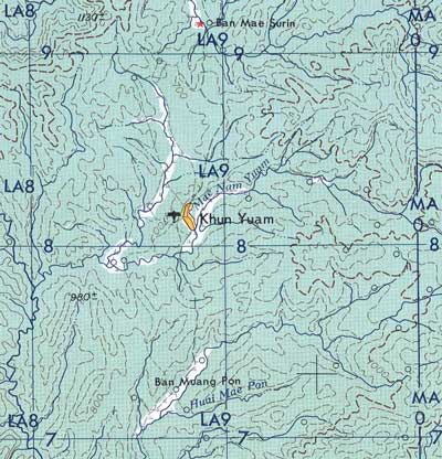
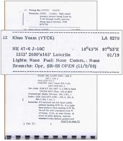
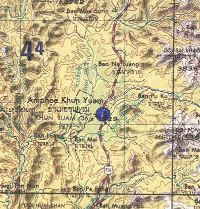
Khun Yuam airstrip appeared in the US Army Corps of Engineers map of the area in 1957: Khun Yuam was carried in Air America listings in 1971:[16a]
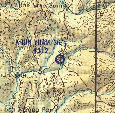
It then appeared in Defense Mapping Agency map for 1975:[16b]
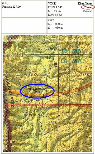
Khun Yuam airstrip continues in listings today. The last Tactical Pilot Chart (TPC) covering the area was issued in 1983, and it showed an air facility at Khun Yuam. That map / chart itself has not been reissued since 1983:[17]
(FIS) Fantacia in the upper left box refers to "Flight Information Service Designation 'Fantacia'[18a]
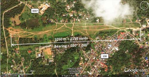
Note that Khun Yuam is here grouped with Mae Hong Son --- the nearest active air facility in the area. The Thai Flying Club has a Khun Yuam Airport webpage, but it does not present much useful information, probably because the facility is unused and unusable. The page does, however, feature an excellent oblique photo of the site; unfortunately, it is mislabeled: rather than looking south per the Club comment, it is actually looking north.[21] As the Thai Flying Club photo demonstrates, however, the site is still very visible from the air. Google Earth offers this view:[22]
The old runway can be traced from the now well-beaten paths wandering over it. The apparent bearing, 020°/200° (02-20), and length, 1150 yards, shown above, compare well with Allied intelligence report data: "NNE-SSW" (22.5°) and "1,100 yards approx". The location cited in the intel report is about 6 km SSW of the actual location; but navigation accuracy back then was limited by the occasional use of a sextant with dead reckoning sufficing between sightings.
|
14.^ Provisional Airfield List, Southeast Asia, Report No 3, (Washington: Office of Assistant Chief of Air Staff, Intelligence, 25 Jul 1944), page XVII, titled "Thailand"; (USAF Archive Reel A1284, p 1411). 14a.^ Siam (Thailand) List of Airfields and Seaplane Stations (Washington: Ass't Chief of Air Staff, Intelligence, 1945), unnumbered page (USAF Archive Reel A1285, p 1233).
15.^ Amendment to Airfield Report No. 33 (Chief Intelligence Officer, Headquarters, Air Command, South East Asia, Apr 1945), unnumbered page, titled "Kun Yom" (USAF Archive Reel B8056, p 201).
15a.^ บ้อมูลเส้นทางเดินทัพทหาร 15b.^ Kirby, SW, The War Against Japan, vol 5 (Uckfield: Naval-Military Press, 2004), pp 260-261.
15c.^ Crozier, S, "Memories of the Shan States", Argus Week-End Magazine. 13 Oct 1945, p 12. The author would appear to have been wife of an expat employee at the Mawchi mine before the war.
15cα.^ Jarun interview in 第二次世界大戦でのクンユアムの人々の 日本の兵隊さんの思い出 ("Thailand-Japan Friendship Memorial" website (as translated from Japanese by google translate).
15cβ.^ ชมธวัช, เชิดชาย, [Chomtawat, Cherdchay], ibid, Interviewee No 6, Mrs Kaew Chansrima, unpaginated. Translation by Chanagun Chitmanat. 15cδ.^ Ibid, Interviewee No 15, Police Sergeant Somboon Tasiti, unpaginated.
16.^ Extract from Chiang Mai, NE 47-6 Series L509, 1957,
US Army Map Service,
16a.^ Air Facilities Data Thailand 432 (?: Air America?, 1971), p 9. See Key for interpreting page content.
16b.^ Extract from Changwat Chiang Mai, Thailand; Union of Burma: NE47-06, Series 1501, 1975, US Defense Mapping Agency Topographic Center, South East Asian War - Area Of Operations, 1965 - 1975, Jim Henthorn website.
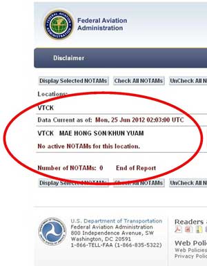
17.^ Tactical Pilot Chart TPC J-10C, Burma, Laos, Thailand, edition 4 (St Louis MO: Defense Mapping Agency Aerospace Center, 1983). While it has not been reissued since 1983, it is kept up to date by NOTAMs (Notices to Airmen). See below.
18.^ Hebel (last updated 2008 per Updated Pilot Charts).
18a.^ Aeronautical Information Package, ENR (en-route) 1.2-1, 27 Nov 03: 'Visual Flight Rules in Bangkok FIR', "VFR Flights Outside Controlled Airspace', 'Call Sign': FANTACIA, 'Responsible Area': "An area bounded by a line joining the following point : 1820N 10110E westward along the nation border to 1713N 09813E then back to the point of origin." This is, offhand, rather confusing since Khun Yuam at N18°49 is roughly 50 km north of this area. 19.^ Sport Pilot Guide is a non-governmental publication, to which Khun Wuthichai, the Director General of the Department of Civil Aviation, has nevertheless lent his photo (General Info, p 60). 19a.^ "A notice containing information concerning the establishment, condition or change in any aeronautical facility, service, procedure or hazard, the timely knowledge of which is essential to personnel concerned with flight operations", Gen 2.2-6, AIP Thailand.
21.^ Notified "info@thaiflyingclub.com" of error by email of 03 Oct 2011; receipt acknowledged same day. No action as of 29 May 2012. 22.^ Google Earth. Accessed 27 May 2012. |
|
