Japan in Northwest Thailand during World War II
| N19°21.50 E99°30.30[1] | Pa Pao (Th: ป่าเป้า / Jp: パパオ ) Williams-Hunt (W-H) Aerial Photomosaics Page 1 of 1 |
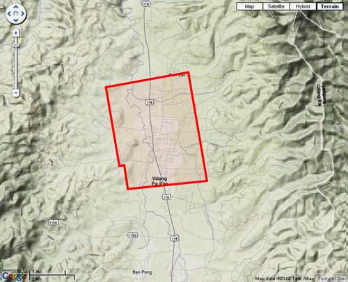
Route 0118 |
| Text | Notes | |||||||||
|
This page discusses World War II aerial photos taken by the Royal Air Force (RAF) and provided on-line by the Geo-spatial Digital Archive Project (GDAP) in its Williams-Hunt Aerial Photograph Digital Collection.[2a]
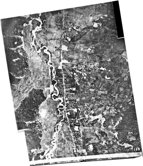
The two-photo aerial photomosaic:[4]
A higher resolution image is available for download here. The following GDAP images were used in the above photomosaic:[5] and assembled approximately like this, using Microsoft ICE:[6]
|
See Key for interpreting page content. Revision list. See bottom of Text column on this page. Bibliography supports notes. 1.^ Source: Google Earth fix on apparent center of town. 2.^ Stationing needed. 2a.^ The collection and its origin are described in detail in: Lertlum, PhD, Col Surat, and Dr Elizabeth Moore, Williams-Hunt Aerial Photograph Collection, (undated); available as here linked. Moore, Elizabeth, The Williams-Hunt Collection, Sari - International Journal of the Malay World and Civilisation, 27(2)(2009), pp 265-284. Periasamy, Makeswary, "A View from the Top", biblioasia, 5(1) (Apr 2009), pp 38-42. 3.^ "Terrain" map from Nations Online Project: Searchable Map and Satellite View of Thailand using Google Earth Data. Annotation (red & blue colored items) were placed by author using Microsoft Publisher. 4.^ Photos were assembled using Microsoft ICE (Image Composition Editor). The mosaic is oriented so that its north is to the top of the page.
5.^ The files used here are 1024 KB. Downloading the files which are designated "[full size]" requires a special request form to be emailed to the Head, GDAP. 6.^ Drawn by author with Microsoft Publisher.
|
|||||||||