| N19°16 E97°56 |
Mae Hong Son Airstrip |
Route 1095 |
| Text | Notes |
|
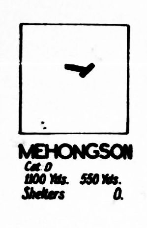
"Miniatures" were a feature of Allied Airfield Reports for a time, designed to provide a quick reference for pilots to as many as 150 air facilities on one page.[18a] This is a "miniature" for the Mae Hong Son airstrip.[19]
Cat [Category] D: Fair weather [use] only.
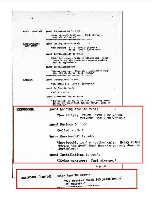
An amendment to reporting in January 1944 was provided to supplement information about the Mae Hong Son airstrip. There are two important points here: 1. Improvement activities seemed to be occurring, indicating the continued presence of IJA troops despite abandonment of the road project --- though this might have been the result of delayed information surfacing after 09 November 1942 2. Two wrecked sheds had been removed. The origins of the sheds is not (probably can never be) clear, but it would be reasonable to assume that this wreckage was left over from the air raids in early 1942 --- and was finally being cleared:[20]
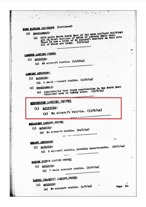
February 1944 No activity at the airstrip was reported, a reflection (finally?) of the 09 November 1943 I J A decision to abandon the Thai-Burma road connection --- but also perhaps evidence of delays in processing data by Allied intelligence:[21]
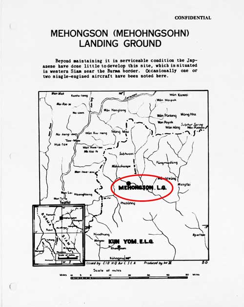
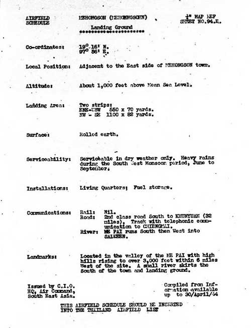
A formal introduction, including a map, was provided for the Mae Hong Son airstrip in Spring 1944.[22] Aircraft reported as "occasionally" present were almost certainly Aerial Transport Company mail planes:[22a]
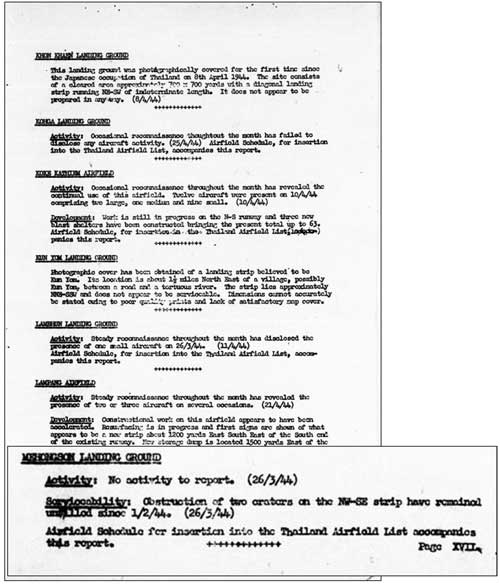
And a standard update on activities observed at the airstrip was included:[24]
That the obstruction provided by two craters on the main runway remained unfilled since 01 Feb 1944 suggests that the craters were the result of an Allied air attack after the last Airfield Report in January; however, there is no record of such. As well, the failure to repair the craters probably reflected changing priorities for the Thai Occupation Army as the I J A's invasion of India matured.
Transcription: It is interesting to note that the meagre line of landing grounds in close proximity to the Burmese border from Mae Hong Son to Mae Sot, including Khun Yuam and Mae Sariang, have not to date been developed. In view of their difficult lines of communication it is unlikely however, that they would be employed for any purpose other than emergency use so that some form of maintenance work is likely to be the limit of their attention.
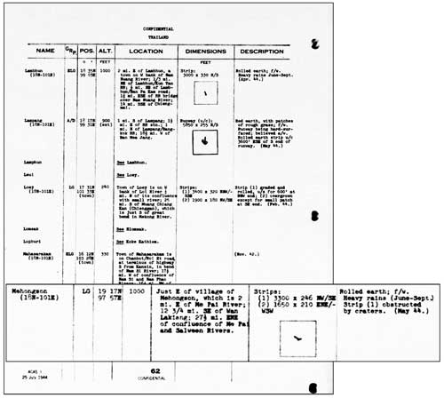
A follow-up three months later provided additional details on the airstrip:[25]
Mae Hong Son was noted on a map of unknown vintage which was reissued to describe evasion/escape routes for downed pilots:[26]
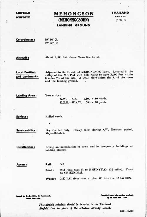
An update provided more details about the airstrip:[27]
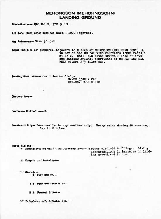
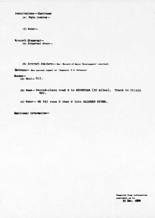
And yet more detail:[28]
|
18a.^ For example, see USAF Archive microfilm reel A8055 p 607 19.^ Airfield Report No. 18, Jan 1944, "Airfield Miniatures": Mae Hong Son, unnumbered page (USAF Archive microfilm reel A8055 p 422)
19a.^"The number of aircraft shelters at each airfield is given as accurately as possible. Shelters wide enough to accommodate aircraft of 65/70 ft wingspan or more are classed as large; those under 65 ft as medium." Airfield Report No. 14, Sep 1943, "Record of Airfield Activity and Development" [my source is currently unclear]. 20.^ ibid, "Amendment to Airfield Report No. 18 [Jan 1944]", Part II. "Amendments to Airfield Lists", "Amendment No. 2", undated, p 36 (USAF Archive microfilm reel A8055 p 475).
21.^ Airfield Report No. 19, Feb 1944, "Record of Airfield Activity and Development", p 24 (USAF Archive microfilm reel A8055 p 524).
22.^ Siam (Thailand) List of Airfields and Seaplane Stations (Washington: Ass't Chief of Air Staff, Intelligence, 1945), unnumbered page (USAF Archive Reel A1285, p 1233) 22a.^ Young, p 216.
23.^ Airfield Report No. 21, Apr 1944, unnumbered page (USAF Archive microfilm reel A8055 p 670).
24.^ ibid, "Record of Airfield Activity and Development", p XVII, (USAF Archive microfilm reel A8055 p 713).
24a.^ ibid, p 4, "Review of Airfield Development in Thailand", (USAF Archive microfilm reel A8055 p 618).
25.^ Provisional Airfield List: Southeast Asia: Enemy Airfield Information Report No. 3, p 62 (USAF Archive microfilm reel A1284 p 1412).
26.^ Extract from "Evasion Map of Burma 3 Sept 44", 'E' Group Periodic Bulletin, Number 2, unnumbered page (USAF Archive microfilm reel A8021 p 0969) NB: date of original map is unstated. The dashed line which starts just to the west (left) of "Me'hohngsohn" (circled) is the recommended escape route from that area. 27.^ Airfield Report No. 28, Nov 1944, unnumbered page (USAF Archive microfilm reel A8055 p 969).
28.^ Siam (Thailand) List of Airfields and Seaplane Stations (Washington: Ass't Chief of Air Staff, Intelligence, 1945), unnumbered pages (USAF Archive Reel A1285, p 1234).
|
.jpg)
