Japan in Northwest Thailand during World War II
| N19°54 E99°50[1] |
Chiang Rai (Th: เชยงราย / Jp: チェンラーイ ) USAAF Aerial Photo Intelligence Page 1 of 1 |
Major transport hub[2] |
| Text | Notes | ||||||||||||
|
Flight reports here record aerial photo coverage of Chiang Rai by only the 21st Photographic Reconnaissance Squadron (21PRS); however no actual photos by the 21PRS have apparently been released. Single instances of other coverage exist, in the form of two actual dated photo sets probably taken by the RAF. See Williams-Hunt Aerial Photomosaics of Chiang Rai. On that page, Photomosaic No. 1 provides an example of aerial photo coverage of the general Chiang Rai area on 05 October 1944. In the absence of hardcopy 21PRS photos, that photomosaic must be assumed to be typical. Location maps for the Chiang Rai Landing Ground are available here.
Aerial photos of the Chiang Rai area were taken this date apparently by the RAF. See Photomosaic No. 2.
Pangiu is today's Pa Ngiu (N19°18 E99°31), located on current Thai Route 118 (roughly half-way between Chiang Mai and Chiang Rai):
To clarify: the town's police station (assumed to be centrally located in the town) was located at ~N19°54.70 E99°49.95 while the airport's runway intersections were located about 3.4 km south at ~N19°52.90 E99°49.60:
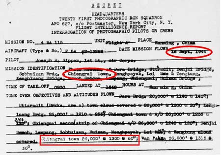
16 September 1944
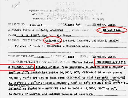
Aerial photos of the Chiang Rai area were taken this date apparently by the RAF. See Photomosaic No. 1. 26 October 1944
Tri-met: see definition.
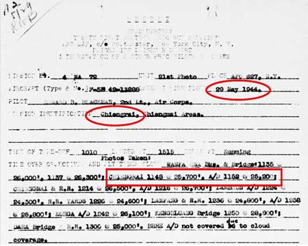
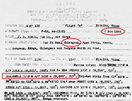
This and subsequent aerial-photo assignments always specify both the town and the airport at Chiang Rai:
05 January 1945
|
See Key for interpreting page content. Revision list. See bottom of Text column on this page. Bibliography supports notes. 1.^ Source: Google Earth fix on apparent center of town. 2.^ Stationing needed.
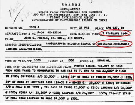
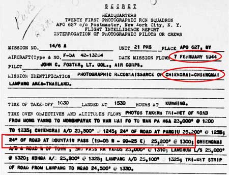
3.^ Identification and coordinates of modern village per getamap. Document: 21st Photographic Reconnaissance Squadron (hereafter 21PRS) Report Mission No. 14/6 A, 07 Feb 1944 (USAF Archive microfilm reel A0878 p0155).
4.^ Coordinates per Google Earth. Document: ibid.
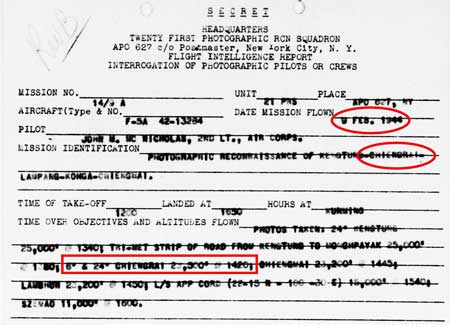
4a.^ 21PRS Report Mission No. 14/9 A, 09 Feb 1944
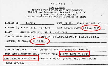
4b.^ 21PRS Report Mission No. 14/23 A, 24 Feb 1944
5. (deleted).
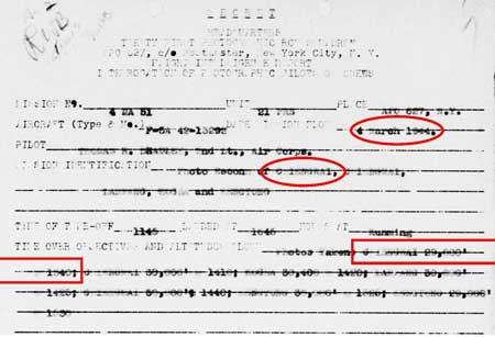
5a.^ 21PRS Report Mission No. 4 MA 51, 04 Mar 1944
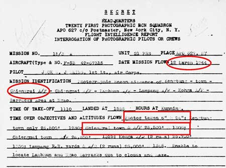
5b.^ 21PRS Report Mission No. 15/3 A, 12 Mar 1944
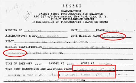
5c.^ 21PRS Report Mission No. 4 MA 44, 14 Mar 1944
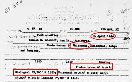
5d.^ 21PRS Report Mission No. 4 MA 62, 24 Apr 1944
5e.^ 21PRS Report Mission No. 4 MA 79, 29 May 1944 440529-USAAF-A0878-p-0010
6.^21PRS Report Mission No. 4 MA 115, 16 Sep 1944
7.^ 21PRS Report Mission No. 4 MA 133, 26 Oct 1944
8.^ 21PRS Report Mission No. 4 MA 133, 26 Oct 1944
9. (deleted)
10.^ 21PRS Report Mission No. 4 MA 139, 02 Nov 1944
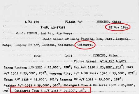
11.^ 21PRS Report Mission No. 4 MA 170, 27 Nov 1944
12. (deleted).
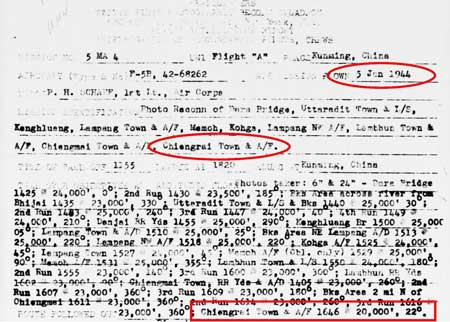
13.^ 21PRS Report Mission No. 5 MA 4, 05 Jan 1945 Note that form is incorrectly dated with 1944, not 1945: the first digit of the report number 5 MA 4 confirms.
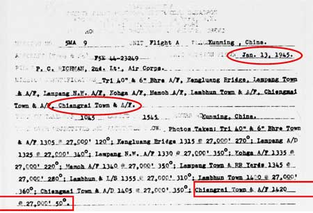
14.^ 21PRS Report Mission No. 5 MA 9, 13 Jan 1945
|
||||||||||||