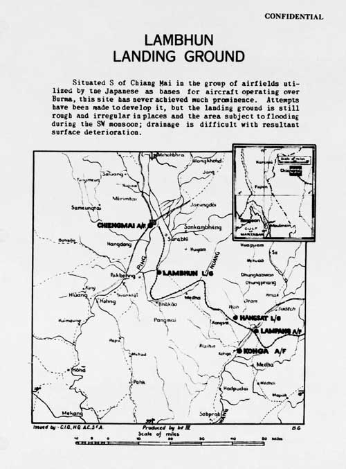
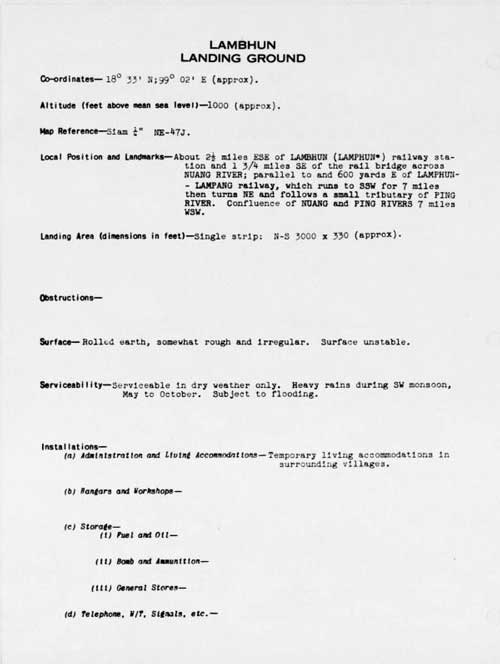
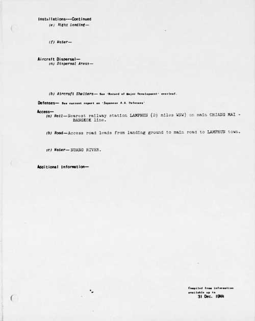
| N18°34.06 E99°02.48 | Lamphun Airstrip (Th: ทางวิ่ง ลำพูน / Jp: ランプーン 滑走路 ) page 4 of 6 |
Route 0011 |
| Text | Notes |
|
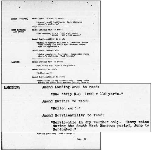
The following corrections page appears to be referring to a page not currently available, but which would appear similar in format to the first page under April 1944 below.[15]
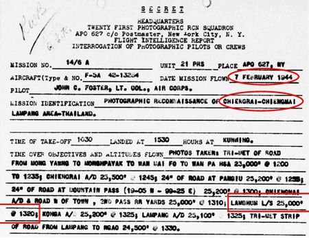
07 Feb 1944: This is the first records currently available of an Allied surveillance aircraft photographing Lamphun, a USAAF P-38 (F-5A) outfitted with aerial photo equipment recorded the area from 25,000 feet (7600 m) at 1320 hrs:[15a]
|
15.^ Airfield Report No. 18, Jan 1944, Part II, Amendment No 2, Amendments to Thailand Aerodromes List, p 36 (USAF Archive microfilm reel A8055, p 475).
15a.^ 21st Photographic Reconnaissance Squadron (hereafter 21PRS) Report Mission No. 14-6A, 07 Feb 1944 (USAF Archive microfilm reel A0878 p 0155). The aerial photo reconnaissance reports included here record coverage of Lampang by only the 21st Photographic Reconnaissance Squadron (21PRS) starting in February 1944. Other Allied units provided similar coverage, but their flight records have not yet been released (Nov 2012).
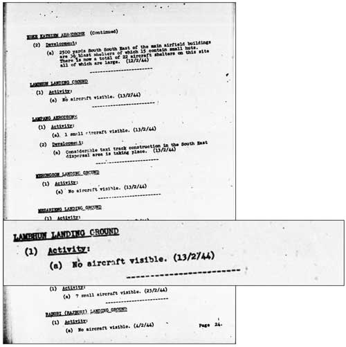
16.^ Airfield Report No. 19, Feb 1944, Record of Airfield Development and Activity, Thailand, p 24 (USAF Archive microfilm reel A8055, p 524).
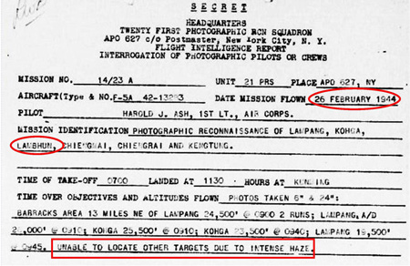
16a.^ 21PRS Report Mission No. 14/23 A, 26 Feb 1944 (USAF archive microfilm reel A0878 p 0118). |
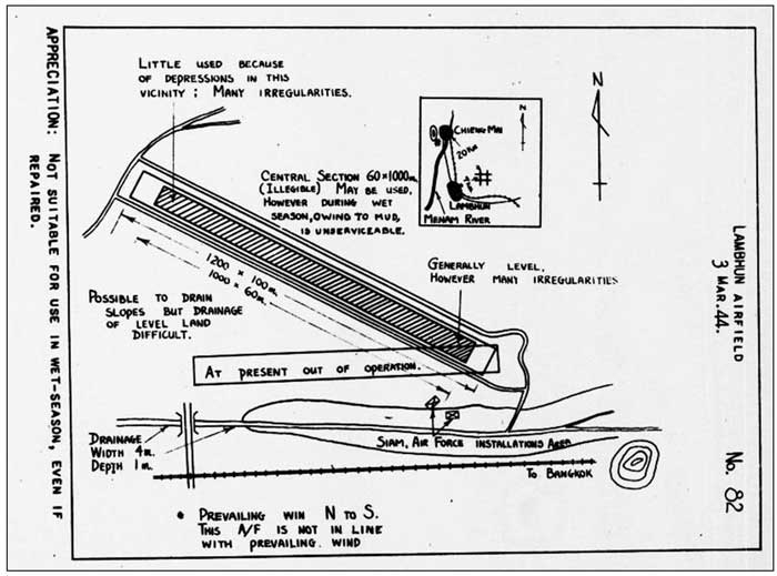
03 March 1944: Despite some repairs, the airstrip was judged "At present out of operation". One critically important point is the correct presentation of the alignment of the airstrip: it is definitely not north-south as previously described; unfortunately that revelation did not carry through to future reports.[17]
|
|
| Text | Notes |
|
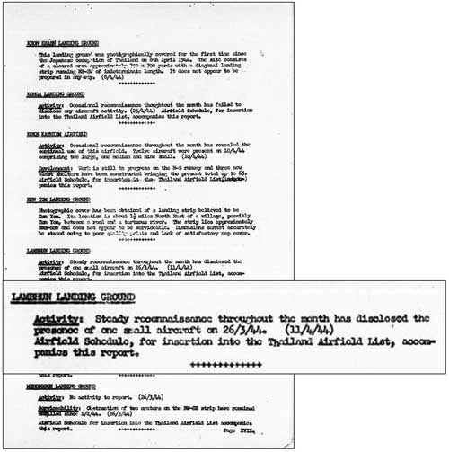
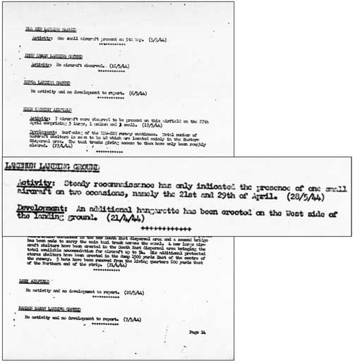
26 March 1944: An RAF photo recon aircraft made a five photo mosaic of the Lamphun town area. It did not include the airstrip in its coverage. On this date, as in December 1943, an aircraft was sighted, again not identified:[18]
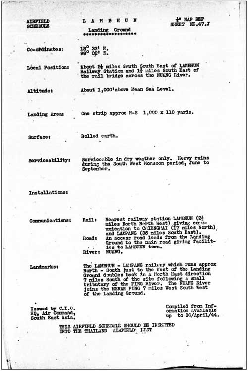
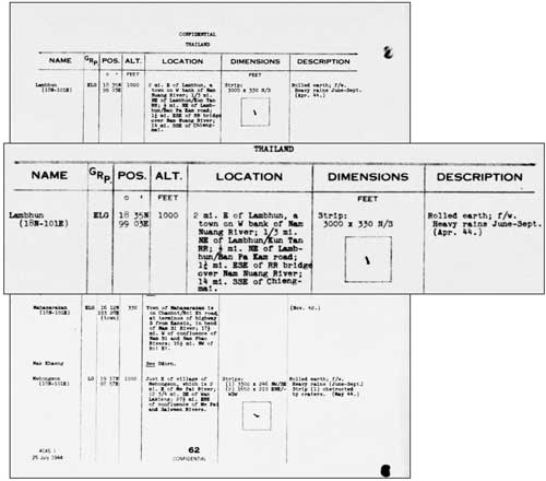
A routine update in a different format:[21]
The GRP entry "ELG" means "Emergency Landing Group". The difficult-to-read details under "Location" are: 2 mi. E of Lambhun, a town on W bank of Nam Nuang River
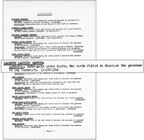
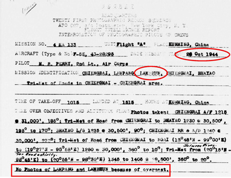
22 Oct 1944: The term, "infrequent cover", ie, "infrequent coverage", suggests that Allied intelligence did not consider the Lamphun airstrip significant.[22]
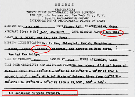
01 Nov 1944: Once again overcast skies prevented photo coverage of Lamphun:[22b]
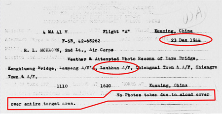
23 Dec 1944: Cloudy weather prevented aerial photo coverage:[22e]
|
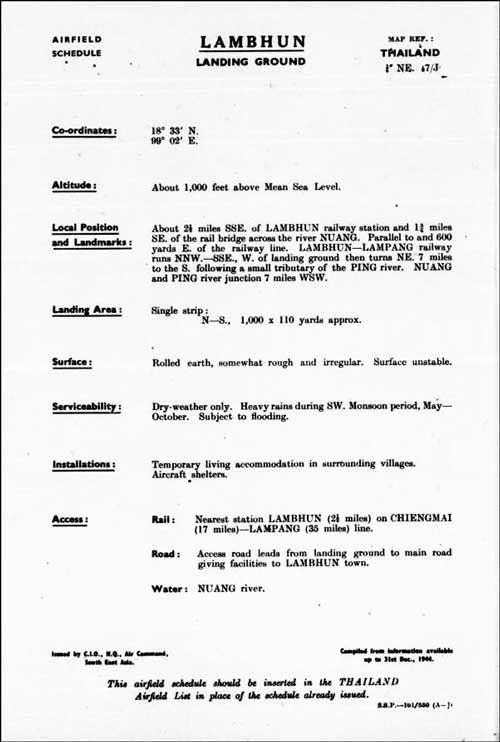
17.^ Plans of Airfields in Fench Indo-China and Siam, Publication No 3II (South-East Asia Translation and Interrogation Center, 30 Nov 1944) (USAF Archive microfilm reel A8023, p 469). 18.^ Airfield Report No. 21, Apr 1944, Record of Airfield Development and Activity, Thailand, p XVII (USAF Archive microfilm reel A8055, p 713).
19.^Airfield Report No 22, May 1944, Record of Airfield Activity and Development, Thailand, p 14, (USAF Archive microfilm reel A8055, p 752).
20.^ Airfield Report No. 21, Apr 1944, unnumbered page (USAF Archive microfilm reel A8055, p 668).
21.^ Provisional Airfield List-Southeast Asia (Burma, French Indo-China, Malaya, Thailand), Enemy Airfield Information, 2? Jul 1944, p 62 (USAF Archive microfilm reel A1284, p 1412).
22.^ Airfield Report No 27, Oct 1944, Record of Airfield Activity and Development, Thailand, p 9 (USAF Archive microfilm reel A8055, p 1019).
22a.^ 21PRS Report Mission No. 4 MA 133, 26 Oct 1944 (USAF archive microfilm reel A0878 p 0552).
22b.^ 21PRS Report Mission No. 4 MA 136, 01 Nov 1944 (USAF archive microfilm reel A0878 p 0567).
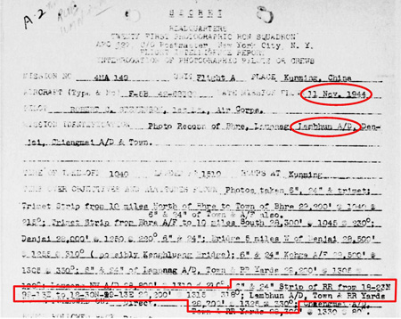
22c.^ 21PRS Report Mission No. 4 MA 149, 11 Nov 1944 (USAF archive microfilm reel A0878 p 0586).
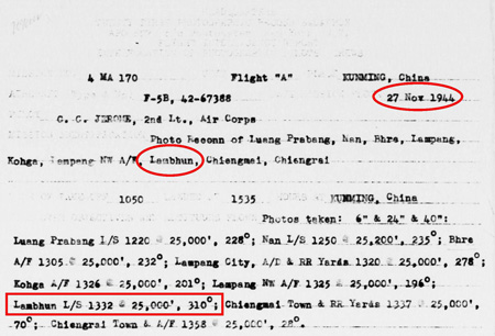
22d.^ 21PRS Report Mission No. 4 MA 170, 27 Nov 1944 (USAF archive microfilm reel A0878 p 0621).
22e.^ 21PRS Report Mission No. 4 MA 41W, 23 Dec 1944 (USAF archive microfilm reel A0878 p 0682).
23.^ Airfield Report No 29, Dec 1944, unnumbered page (USAF Archive microfilm reel A8055, p 1150).
24.^ Siam (Thailand) List of Airfields and Seaplane Stations (Washington: Office Assistance Chief of Air Staff, Intelligence, 1945), unnumbered pages (USAF Archive microfilm reel A1285, pp 1217-1219).
|
