| N18°34.06 E99°02.48 | Lamphun Airstrip (Th: ทางวิ่ง ลำพูน / Jp: ランプーン 滑走路 ) page 3 of 6 |
Route 0011 |
| Text | Notes |
|
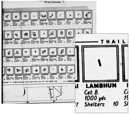
"Miniatures" were a feature of Allied Airfield Reports for a time. Each miniature emphasized airfield configuration and alignment. They were designed to provide a quick reference for pilots to as many as 150 air facilities on one page. This is a miniature for the Lamphun airstrip:[8]
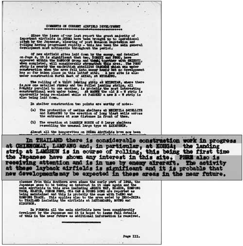
"Cat. B" indicates "Believed [to be usable in] all weather". The bearing of the airstrip would appear to be in error (see corrected aerial photo below). The commentary below suggests that the IJA had assigned a low priority to the Lamphun airstrip until approximately November 1943. That date is significant because it implies that improvements to the airstrip were part of the preparations for support from Thailand for the IJA's planned 1944 invasion of India:[9]
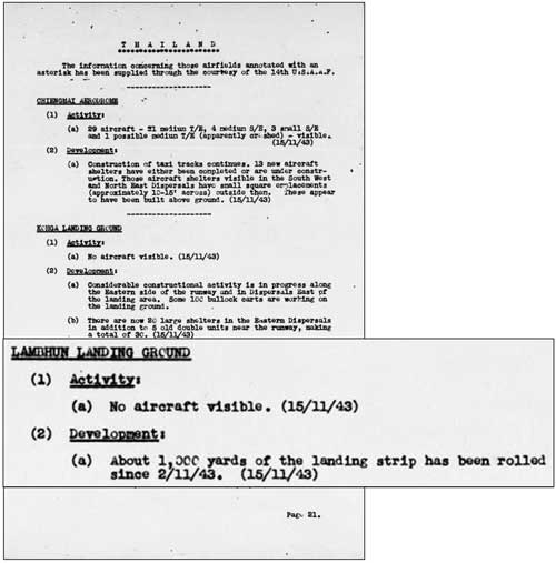
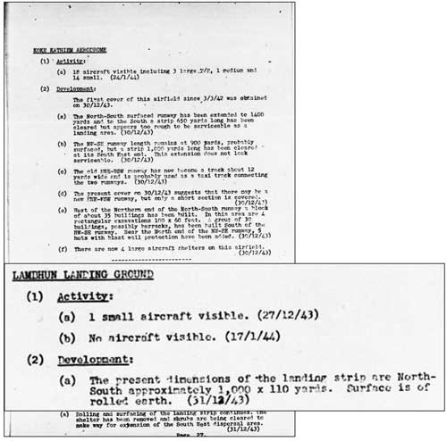
. . . the landing strip at LAMBHUN is in course of rolling, this being the first time the Japanese have shown any interest in this site. . . .
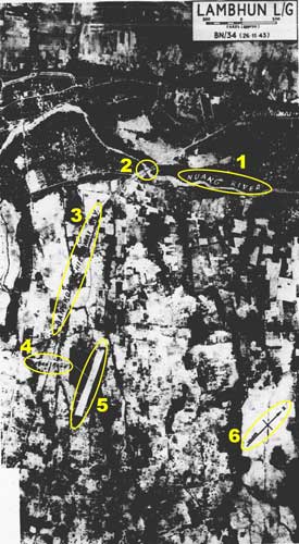
1. "Nuang River" which flows south through Lamphun town
Click on image for enlargement
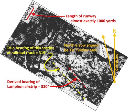
The correction is based on the known bearing of the straight section of railroad track marked with a yellow "center line" in the photo above. It is "known" because the track is still in use today.[13] With alignment of the aerial photo corrected, it can be properly positioned, as shown on the location map on page 1.
And, probably following the misinterpretation of an aerial photo analyst, the text under "(2) Development" continued the fiction of the strip as oriented "north-south".[14]
|
8.^ Airfield Report No 16, Nov 1943, "Miniatures", unnumbered page (USAF Archive microfilm reel A8055 p 230).
9.^ Airfield Report No 16, Nov 1943, page III (USAF Archive microfilm reel A8055 p 236)
10.^ Airfield Report No 16, Nov 1943, page 21 (USAF Archive microfilm reel A8055 p 276)
11.^ Airfield Report No 21, Apr 1944, unnumbered page (USAF Archive microfilm reel A8055 p 657). NB: while dated 26 Nov 1943, the photo appeared in a report five months later. Annotations by author using Microsoft Publisher.
12.^ ibid.
13.^ Information derived from Google Earth.
14.^ Airfield Report No. 18, Jan 1944, Record of Airfield Development, Thailand, p 27 (USAF Archive microfilm reel A8055, p 470).
|