| N18°11.90 E99°24.67 |
Ko Kha Landing Ground (Th: เกาะคาท่าอากาศยาน/ Jp: コカ滑走路) Lampang Province Page 3 of 3 |
Route 0001 Sta 690~ |
| Text | Notes | ||||||||||||||||||||||||||||||||||||
|
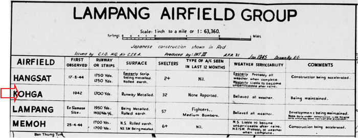
January 1945: The first map of the Lampang Airfield Group included this table:[11]
|
|||||||||||||||||||||||||||||||||||||
|
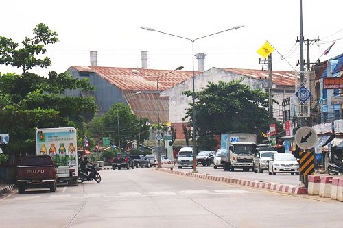
There is an excellent aerial photo of the sugar mill area dated 15 Jan 1954, which includes much, but not all, of the airstrip. It is available here. The airstrip would appear not to have been used or maintained after the end of the war. There is an interesting detail to the southeast of the airstrip: six revetments were still visible, similar to the one seen in this extract from a 1944 aerial of Lampang airfield.[13a1] The airstrip at Ko Kha does not appear on flight maps following the war (maps dated 1958, 1973, 1983). 11 September 1968: Air America recorded the runway as closed on this date. Details included:[13b]
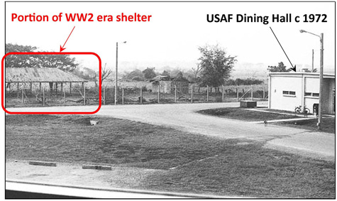
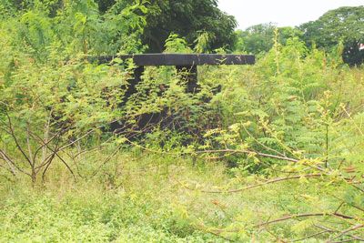
1971: USAF/GE Space Cmd AN/GPS-10 spacetrack radar was established here. A Google-based map locates its facilities at Ko Kha Air Station and provides some history.[13c] Note particularly that the Route 1 Bypass cutting through the air station site had already been built before the USAF arrived. A sequence of photos of the USAF site taken from 1972 periodically up to the present by Ken Schmidt appears on flickr at Ko Kha Air Station, Thailand. Of particular interest is one photo which confirms the existence of a structure shown on the Allied intel sketch of 1943 on page 1. The structure turns out to have been a roofed open-walled shelter:[13c1]
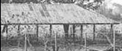
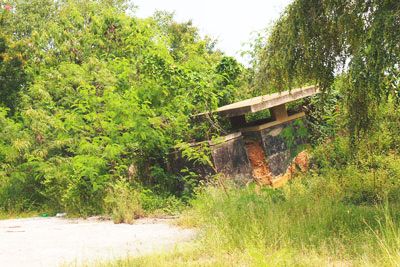
A closeup of the shelter:[13c2]
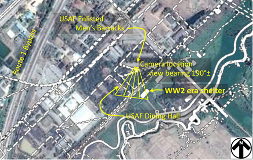
The location of the shelter is shown here in a current Google Earth view overlaid by the 1943 Allied intel sketch (shown with white lines):[13d]
Coordinates for the shelter were approximately N18°11.92 E99°24.67. The structure scaled out on both the Allied intel sketch and aerial photo at roughly 30m x 12m. The spacing between roof supports wasn't sufficient to allow an aircraft to use it as a hangar (rather than in roofed shelters, aircraft were typically housed within open revetments, though none appear in the 1943 sketch). The purpose for the shed is unknown. 1976: The USAF spacetrack radar station was closed. |
11.^ Airfield Report No. 31, Feb 1945, "Lampang Airfield Group" (map) (extract), unnumbered page Note that the table is dated January 1945 and is carried here chronologically as in that month; however, the table was actually published in the February edition of the Airfield Report.
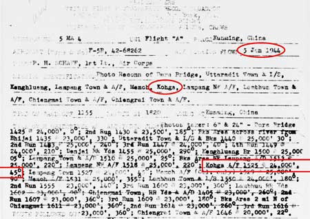
11a.^ 21PRS Report Mission No. 5 MA 4, 05 Jan 1945 Note that form is incorrectly dated with 1944, not 1945: the first digit of the report number 5 MA 4 confirms 1945. This is a typo that commonly occurs at the beginning of a new year.
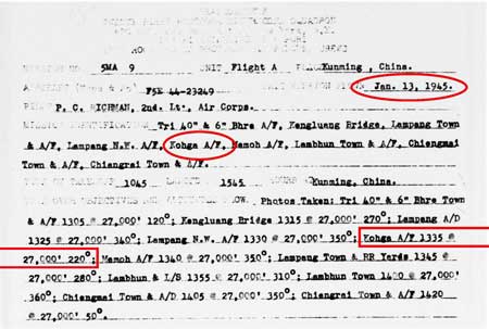
12.^ 21PRS Report Mission No. 5 MA 9, 13 Jan 1945
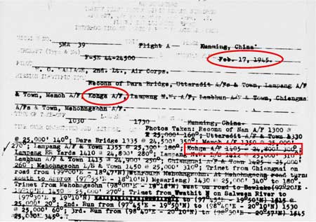
13.^ 21PRS Report Mission No. 5 MA 39, 17 Feb 1945
13a.^ This section added 29 May 2014. Steve Druzak's recollections (various emails starting 1711 14 May 2014) stirred me into looking at the USAF presence at the site. 13a1.^Post added to 2bangkok forum "WW2 airfield Koh Kha, Lampang" by Wisarut Bholsithi on 26 Sep 2014 1219 hrs. 13b.^ Air Facilities Data Thailand 432, (?: Air America, 01 Feb 1971), p 20.
13c.^ There is a minor error in the general information provided there: the Wang River flows from Lampang, not to Lampang.
13c1.^ Photo by Ken Schmidt, taken c 1972, as shown in his flickr account: untitled photo. A comment from Keith Hicks on the flickr page locates Ken Schmidt's view as from the second floor of the Enlisted Men's Barracks. Annotations by author using Microsoft Publisher.
13c2.^ Ibid, extracted.
13d.^ Allied intel sketch, shown in white, overlaid on Google Earth view at N18°11.92 E99°24.66, using PhotoShop. The USAF Enlisted Men's Barracks and the Dining Hall, both labeled on the Google Earth view, appear indistinct because the buildings were long ago removed and what shows in the view are the foundations. The Google Earth view appears in lesser detail in the image directly below. Annotations by author using Microsoft Publisher. |
||||||||||||||||||||||||||||||||||||
|
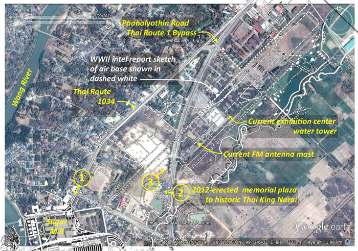
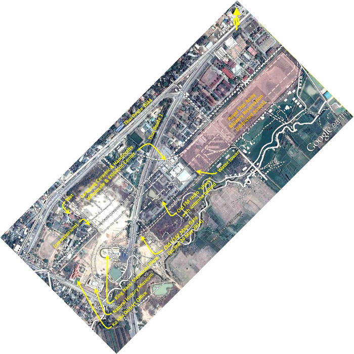
Ko Kha is a dynamic part of Thailand, and its landscape has been vastly altered since the war. Below the WW2 intel sketch of the air base from page 1 is superimposed as dashed white lines on a current Google Earth view of the area to show the approximate location of the old airstrip:[14]
A larger, higher resolution image of the above can be downloaded at Ko Kha overlay 1. The circled numbers above provide reference for locations of the views which follow. Here is a closer look at the air base / station site proper:[14a]
And a larger, higher resolution image of the above can be downloaded at Ko Kha overlay 2. |
|||||||||||||||||||||||||||||||||||||
|
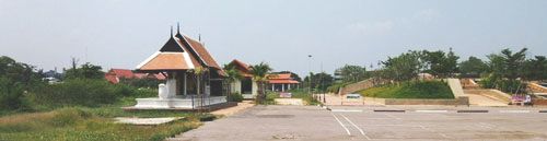
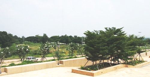
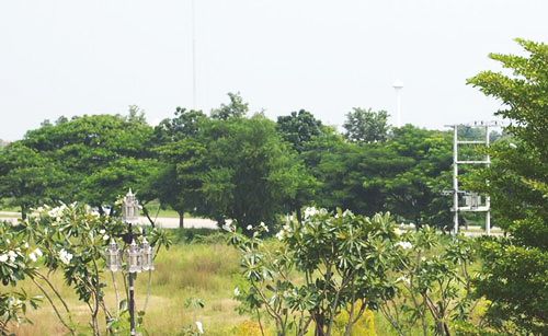
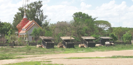
The antenna mast in the distance is approximately on the center line of the old airstrip. The water tower is closer in and just off the right edge of the old runway. The ladder‑like structure to the right is for a set of pole‑mounted power transformers along Thai Route 1. A drive around found only the perimeter roads for the industrial park as evidence of the old airstrip. The concrete structures pictured below are near the monument, but they are not pillboxes or guard shelters, but rather toilets for a public park from a later era:[21]
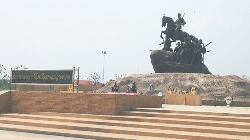
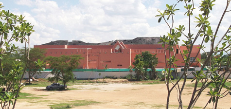
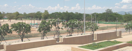
The King Narai plaza monument was completed last year and photos above recorded its appearance in October 2013. Development at the south end of the site of the WW2 Ko Kha airstrip continues. To the south of the plaza, a large building to house a natural history museum has been erected, to be opened in 2015: [24]
October 2103: this photo is the same photo as above, but enhanced and cropped:[25]
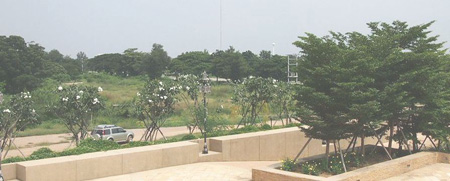
May 2014: note that the grassy field between the monument and the treeline in the distance has been cleared and some foundations have been poured. Curiously, the trees in the planter at near right have been removed.[26]
|
14.^ Google Earth view overlaid with earlier sketch using Adobe Photoshop; annotated by author using Microsoft Publisher. 14a.^ Google Earth view overlaid with earlier sketch using Adobe Photoshop; annotated by author using Microsoft Publisher. 15.^ PA070874a.jpg
16.^ PA070836b.jpg
17.^ PA070854a.jpg
18. (deleted)
19.^ PA070846a.jpg
20.^ PA070847a.jpg
21.^ A070863.jpg
22.^ PA070864.jpg
23.^ This section added approx 15 May 2014.
24.^ Extract from:
25.^ Extract from:
26.^ Extract from:
27.^ Extract from:
|
||||||||||||||||||||||||||||||||||||