| N18°21 E99°25 |
Hang Chat Landing Ground (Th: ห้างฉัตรท่าอากาศยาน / Jp: ハンチャツ滑走路) Lampang Province Page 2 of 3 |
near Hang Chat RR Station on Northern Route Sta 654.85 |
| Text | Notes | ||||||||||||||||
|
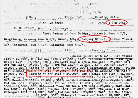
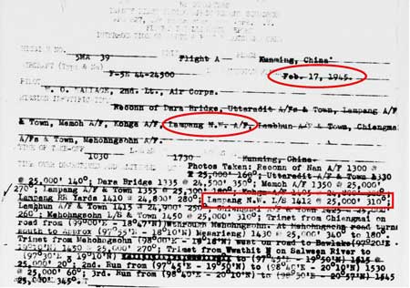
05 January 1945: "Lampang NW A/F" was specified as a photo target for this flight and photos, as specified, of "Lampang NW A/F" were reported as taken:
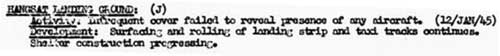
The accompanying text for the above aerial photo reads: HANGSAT LANDING GROUND IN THE LAMPANG GROUP, SIAM This Japanese originated Landing Ground was first reported when in a fairly advanced stage of construction in April 1944. It is situated in the important LAMPANG Airfield Group in Northern SIAM and is being progressed simultaneously with the new site at MEMOH but work appears to be proceeding here quicker. Two parallel landing strips are both oriented N-S each some 1,800 yds in length with dispersal developing between them and to the North. When serviceable all types of Japanese aircraft will probably be able to operate from this site. While the text reads "first reported when in a fairly advanced stage of construction in April 1944", this conflicts with the first comment about the strip which appeared in reports at least currently available, dated August 1944: "This is a new site located for the first time on the 17th August". The 17 August 1944 date is adhered to in the following entry: The entry above for "Hang Sat" reads:
Note that while no subsequent 21PRS flight records list "Lampang NW A/F" (or "Hang Chat" for that matter), other Allied aerial photo reconnaissance units may have provided coverage at later dates.
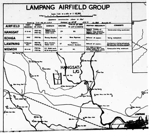
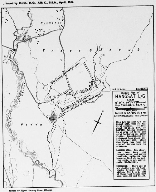
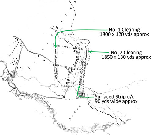
TRANSCRIPT of text box: Sketch Plan of [Hang Chat] L/G [Landing Ground] Siam This L/G was seen u/c [under construction] in August 1944, when it was first covered. It lies about 6-3/4 miles NW of Lampang Railway Station in an area of trees and scrub bordering on paddy fields. Considerable development took place until February 1945, since when there has been no sign of further work in progress. LANDING AREA: Two clearings have been cut through scrub and partly levelled, surfacing has begun on No 2 strip, neither strip is yet serviceable (16/Mar/45). DISPERSAL: There are 12 a/c [aircraft] shelters on the taxi-tracks between the two strips. The N & S ends of these taxi-tracks have been levelled and rolled. While the above map sketch provides excellent detail, the north arrow shown is about 45° off: it should point in the same direction as the airstrips which are both nearly north-south. This is the sketch, properly realigned, with image-north towards the top of the page: Relevant information in the sketch has also been transcribed and inserted. Note that only the easterly runway had been "surfaced".
No further mention of the Japanese air facility at Hang Chat has been found in Allied records available to date.
|
7.^ 21PRS Report Mission No. 5 MA 4, 05 Jan 1945
Note that form is incorrectly dated with 1944, not 1945: the first digit of the report number 5 MA 4 confirms 1945. Such typos are typical shortly into the new year.
7a.^ Airfield Report No 30, Jan 1945, "Record of Airfield Activity and Development", p 6 (USAF Archive microfilm reel A8055 p1269).
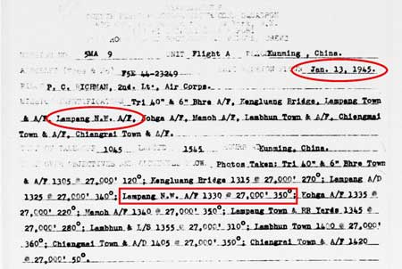
8.^ 21PRS Report Mission No. 5 MA 9, 13 Jan 1945
8a.^ Airfield Report No 30, Jan 1945, unnumbered pages between pp iiia and iv, photo undated (USAF Archive microfilm reel A8055 pp 1246-1247).
8b.^ Airfield Report No 31, Feb 1945, unnumbered page, dated Jan 1945 (USAF Archive microfilm reel A8056 p 0003). While the map was carried in the Feb 1945 publication, the map itself is dated Jan 1945.
9.^ 21PRS Report Mission No. 5 MA 39, 17 Feb 1945
9a.^ Airfield Report No 33, April 1945, unnumbered page, sketch dated 16 March 1945 (USAF Archive microfilm reel A8056 p0149)
9b.^ ibid, extract. Annotated by author using Microsoft Publisher.
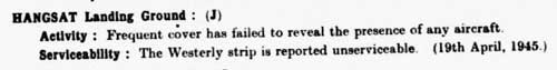
10.^ Airfield Report No 33, April 1945, "Record of Airfield Activity and Development", p (3) (USAF Archive microfilm reel A8056 p 0165).
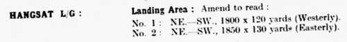
11.^ Airfield Report No 33, April 1945, "Part II: Amendments to Airfield Lists", p (10) (USAF Archive microfilm reel A8056 p 0173).
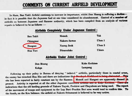
12.^ Airfield Report No 34, May 1945, "Comments on Current Airfield Development", p (1) (USAF Archive microfilm reel A8056 p 0294).
|