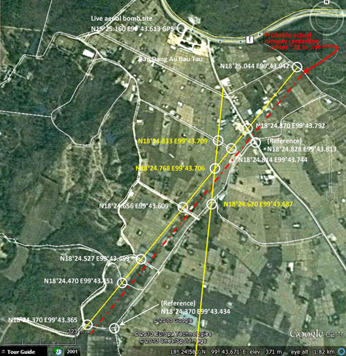
| N18°25 E99°44 |
Mae Mo Landing Ground (Th: ท่าอากาศยานแม่เมาะ / Jp: マイモ滑走路) Lampang Province Page 3 of 4 |
Thai Route 0001 Sta 000.00 offset 0.8km south |
| Text | Notes | ||||||||||||||||||
|
Postwar information The very poor quality photo of the Mae Mo Landing Ground below was published in a Chiang Mai Museum report in 1999. The actual date of the photo is not known: The caption (translated) reads: Fig 10. Airport built by Japanese soldiers during WWII. It is now located in the Mae Mo Forestry Plantation, Ban Ta Sri, Tambon Ban Dong, Amphoe Mae Mo, Lampang Province. Before it was finished, it was attacked. Though that description was known to us in early 2008 and was more specifically defined in early 2010[28], a thorough inspection of Google Earth's rendering of that area had found nothing suggesting an airstrip. We came to that conclusion with the experience of having visited the airstrip at Khun Yuam which, though not used since 1946, has survived very nicely. That conclusion turned out to be in error. No further progress was possible until we discovered offerings of the US Air Force Historical Research Agency (AFHRA) in mid-2011. After ferreting out the information relevant to Mae Mo in webpages 1 and 2, and with numerous delays, we eventually found ourselves driving around the area indicated in the maps and diagrams on page 2 on 25 July 2013.
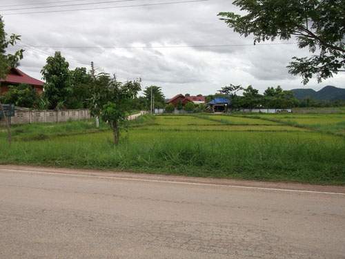
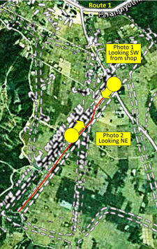
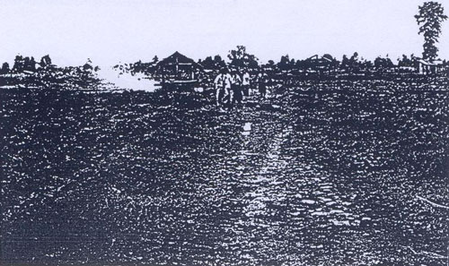
Looking out from his shop and across the road in a southwesterly direction, down what would have been the runway center line, we saw open fields bounded by a tree-lined, gravel road (to the left in the photo below): Photo 1 [30]
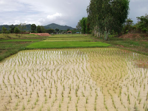
Photo 2 [31]
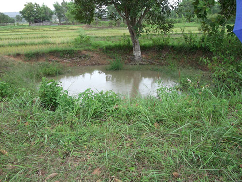
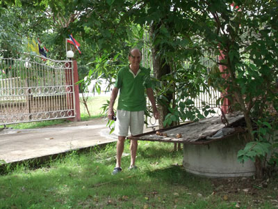
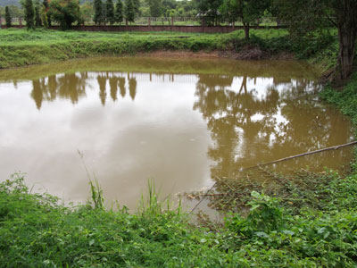
On that smaller road, we stopped and walked along paddy field dikes to look at various holes, which the shopkeeper thought might be vestiges of bunkers. Most of them turned out to be purpose-built unlined water reservoirs. However, two were decidedly different. Circular in shape, each looked similar to an old bomb crater we had seen in Chiang Mai on the old Sang Thai Rice Mill property. Diameters of the two here differ: 8 m and 13 m (approximate). The shopkeeper had mentioned that he thought the airfield had been bombed. Here is one of the two holes which appear to be bomb craters:
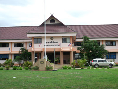
The shopkeeper also mentioned that there were possibly remains of a bunker near the local government building just up the street, at the intersection with Thai Route 1. So we ventured back over there where we found a standard Thai government building, in this case the administrative office for Tambon Ban Dong. It is located where the overlay on page 2 shows "Huts" near the top of the diagram:
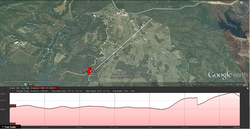
It is curious that the Mae Mo airstrip had been bombed. The airstrip was hardly of any significance: the reports on the previous pages indicate no aircraft were ever sighted there. The bombing might have been by Allied pilots whose only orders were bomb "targets of opportunity"; or it might also have been the result of pilots purposefully dumping their unused bombs before returning to base. There was a remark in a 19 June 1944 mission report, B-247, that a 22nd Bombardment Squadron, having failed to sight its target (the Kaeng Luang bridge), had "spotted an airfield having two runways crossing in an 'X' pattern" and dropped all its bombs on this alternate target. The Mae Mo facility is the only one in the northern Thailand area with runways in an "X" pattern. For reference purposes, a profile of the main airstrip: The abrupt elevation change towards the right (NE end) may be the result of a seam between two aerial images stitched together by Google Earth to form a mosaic. A larger image is available here.
|
27.^รายงาน การ สําร จอขุดค้น ตาม โครงการ Unique among the images in the report, only this one is unattributed. Hence, I don't know where to look for a better copy, or how to date it or determine its direction of view. The title of the museum report specifies Mae Hong Son Province. Why this photo of a site in Lampang Province, two provinces to the east of the subject province, is included in this report is unclear. 28.^ Mae Mo Airstrip location per Sakpinit Promthep:
29.^ Photo is extracted from DSCF1599.jpg, 25 Jul 2013. Shopkeeper/shop owner: Sawai Maneesarn นายเสวย ทวีสาร 30.^ DSCF1592.jpg of 25 Jul 2013.
31.^ DSCF1610.jpg of 25 Jul 2013.
32.^ Portion of image attributed in footnote 24, with additional annotations by author using Microsoft Publisher.
33.^ DSCF1602.jpg of 25 Jul 2013. Coordinates of shell crater (diameter 8m) shown: Coordinates of shell crater (diameter 13m) not shown: [Coordinates added:
34.^ DSCF1613.jpg of 25 Jul 2013. Building front faces approximately north.
35.^ DSCF1619.jpg of 25 Jul 2013
36.^ DSCF1615.jpg of 25 Jul 2013.
36a.^ Jack Eisner recounts hearing a similar story at a far distant, unrelated location; point being, the spirit world continues to be a very real factor in the outlook of some Thais.
37.^ Google Earth view of Mae Mo location and "show elevation profile" activated.
37A.^ Google Earth image enhanced with IrfanView and annotated with Microsoft Publisher by author. Location coordinates per Google Earth. |
 Sawai Maneesarn