| Details of Aircraft Losses by Date |
| Text | Notes | ||||||||||||
|
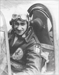
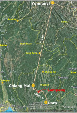
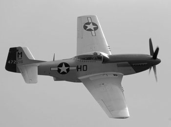
11 Nov 1944: USAAF 2Lt Henry Minco was homebased at Yunnanyi, Yunnan, China, assigned to the 25th Fighter Squadron, 51st Fighter Group, in the 14th Air Force.[0] While he had extensive combat experience with P-40 fighters, on this date, he flew a P-51 for which he had been provided no training, and with only the experience of having ferried one from Calcutta to Yunnanyi. On this date, he flew as part of a mission for an "offensive reconnaissance of railroad Chiengmai to Dara Bridge"; alternate targets were defined as "field sweep[s] of Chiengrai, Chiengmai, and Lampang Airfields".[1]
In the ensuing combat, Minco pursued one Nate towards a mountain slope and, misjudging his own greater speed, overtook the enemy plane. He chose to fly beneath the Nate and then had to climb quickly to avoid hitting the mountain. As he pulled up, he came into the Ki-27's gunsight; the pilot fired, Minco was hit and crashed into the mountainside.[2]
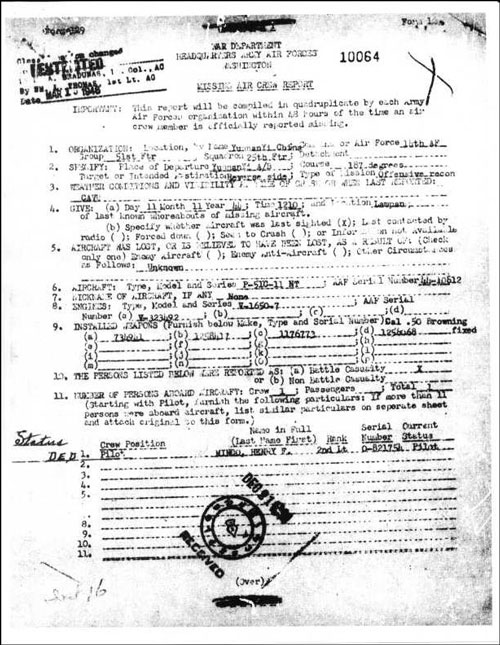
Minco's unit generated a Missing Air Crew Report (MACR):[3]
Key items:
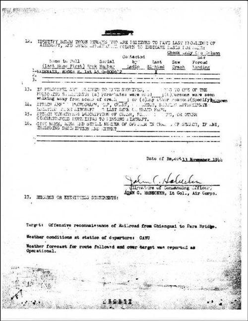
The MACR continued:[4]
Key items:
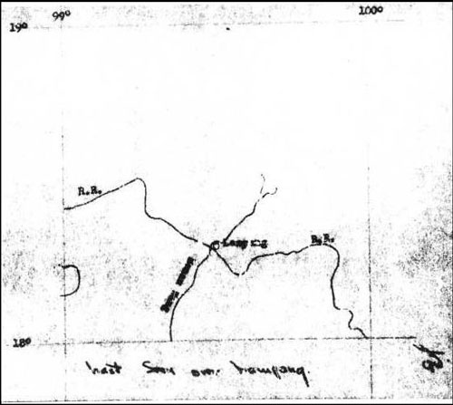
A map was included in the MACR:[5]
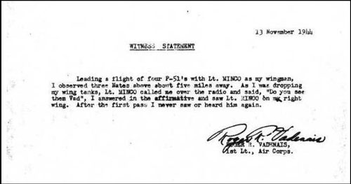
Note that the map is so small in scale and devoid of detail as to be meaningless. A statement by Minco's flight leader was included in the MACR:[6]
Witness statement:
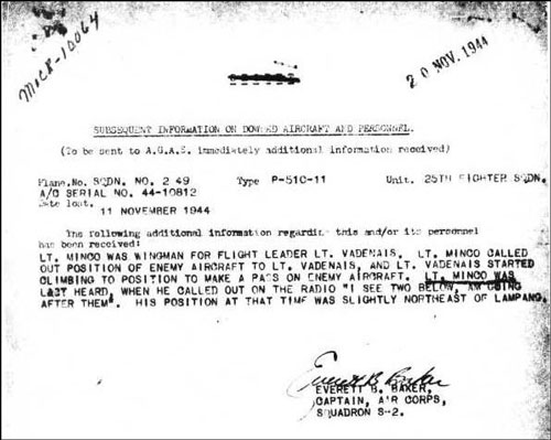
Additional information, dated 20 Nov 1944, included in the MACR:[7]
Key text:
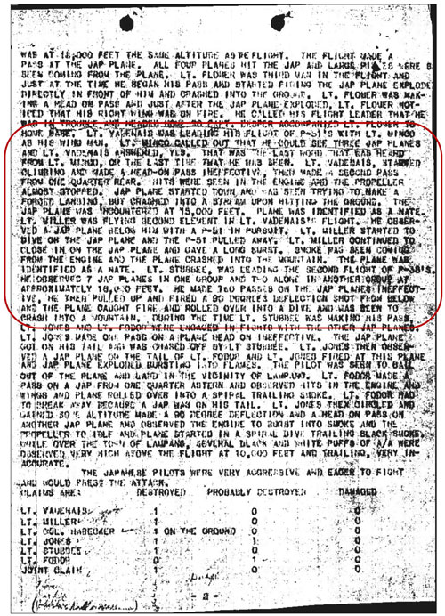
A standard and more detailed Flight Operational Intelligence Report was issued:[8]
which read in part (circled area):
Note that only the first paragraph above refers to Minco. The two paragraphs that follow are included because of their mention of enemy aircraft crashing into a mountain. Years later, a review of reports by Thai pilots found no Thai aircraft crashing into a mountain. Hence, the crashes on a mountain witnessed by two USAAF pilots could only have been one crash, that of Minco's P-51. USAAF Chronologies recorded:[9]
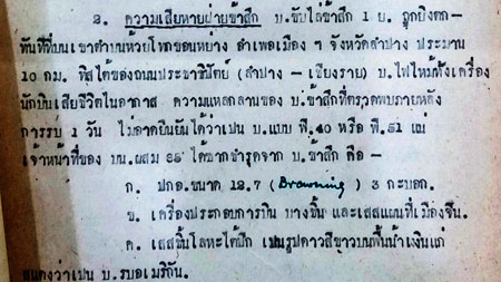
Meanwhile, the RTAF generated its own report on Minco's crash:[10]
In translation:
Unfortunately, there is no / never was a Tambon Huai Toke Khon Yang in Amphoe Muang, Lampang; nor is there a tambon by that name anywhere in Thailand.[10a] The Huai in the name indicates a waterway, with name, Toke Khon Yang. However, no stream with that name appears on Royal Thai Survey Department maps of the area.[10b] A clarification that Prachatipat Road is now called Phahonyothin Road, while correct, was of no value: the road is north-south extending from Bangkok in the south to Lampang with an additional 200+ km north to Mae Sai at the border with Burma. So "10 km south of" a north-south road in this instance is meaningless. In the summer of 1946, an American Graves Registration Service team was unable to locate Minco's remains and recommended that the effort be abandoned because of local conditions --- dense jungle and monsoon-type weather. A formal hearing in Calcutta in October accepted the recommendation and closed the case.[11] Because the RTAF victory against the more modern, better equipped and trained Allied forces was a "David and Goliath" type event with the RTAF playing a "David", it has been well recorded in Thai literature which will be reviewed on a separate webpage. One account, written in 1992 by a local newspaper editor, Sak Rattanachai, recorded the crash site as in the valley of Gulua Mountain-Mon Phaya Chae:[12]
Another unfortunate detail: the mountain name, Gulua, ดอยกุลัว, is an unknown, but in retrospect might have been a severe corruption of a tambon name at the south end of the mountain ridge: Kluai Phae (กล้วยแพะ). But Mon Phaya Chae, ม่อนพญาแช่, is the name of a well-known wat in the foothills of Doi Farang overlooking Lampang town.
Left: Boonyen Khantakrua, บุญเย็น, 75 year old guide extraordinaire, who is familiar with the area because he regularly maintains fire breaks on the mountainsides.[13] Corroborating the event were two elderly local Thais:
He did not immediately visit the crash scene; but heard that the plane had been broken into many small pieces. He described the site as at the Huai Pew, a tributary of the Huai Toke Khon Yang. Many months later (ie, not years), which would probably have been shortly after the end of the war, he remembers that a foreigner came, hired a guide from Ban Sai Tai, and went to the site. He heard nothing further about the visit. Possibly twenty years later (~mid-1960s), while collecting firewood, Sukam passed through the crash site, and saw nothing to indicate that it was a crash site: ie, the area seemed to have been thoroughly scavenged --- there was no hint of debris.
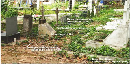
While access to the site was initially restricted by authorities, a relative who was in the military allowed them in. Regardless of the restrictions, there were many people at the site. Most wanted to take pieces of wreckage, but were stopped by the authorities; however, onlookers did collect many coins. He remembers that paper money was said to have been burned. The cockpit was still recognizable and several pistols were beside the seat. There was also a shotgun, badly damaged. Large pieces of wreckage were taken away by the soldiers or police. The military took photos. The pilot's body was not in the cockpit; Dtib saw only a badly burned upper torso and head on the open ground. Those remains were cremated at the site the same day. He didn't know the pilot's nationality at the time. He returned possibly the next year and saw villagers collecting metal and shell casings to sell. He doesn't recall any foreigners coming after the war to inspect the site. There is a story that Minco's remains were recovered and buried by missionaries. It seems to have originated in Clifford Long's diary entry of 21 Feb 1945 with the source noted as "natives".[13c] An online presentation in Thai, ลำปาง ยุทธเวหา (Battle of the sky above Lampang by Col. Rach Rachanawichan), which was apparently uploaded in 2013, identified the missionaries as somehow associated with Van Santvoord Hospital; the colonel has not been available to discuss his source or make clarifications.[13d] It is not clear if: • Missionaries were from Van Santvoord Hospital and buried If buried at Rong Sam Duan, Minco might be in one of two marked, but unidentified, graves amongst a small group of Americans buried there which included Carl Hansen, a former US Consul who died in 1929.[13e]
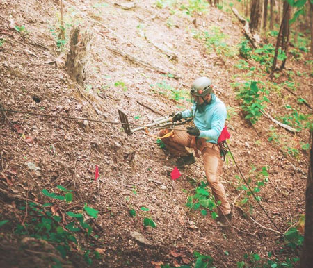
With additional input from Dan Jackson, who visited Sai Tai on 06 Dec 2018, and Sakpinit Promthep, the information was passed to a representative of Detachment 1 of the Defense POW/MIA Accounting Agency (DPAA) in the US Embassy in Bangkok. The agency is tasked with providing "the fullest possible accounting of missing personnel from past conflicts".[14] That representative[15] with staff visited the site on 08 Nov 2019 and found pieces of wreckage confirming that an aircraft had crashed there, and recommended to the DPAA office in Honolulu that further investigation appeared warranted. During the period 23 Apr - 01 May 2021, a multi-discipline DPAA investigative team from Honolulu explored the Minco site.[16] The effort turned up numerous pieces of wreckage, one of which was firmly identified as framing from the cockpit canopy of a P-51,[17] the same model aircraft flown by Minco. While nothing found could identify the aircraft as that flown by Minco, the tream found a Conmar brand zipper pull which was typical of that on flight jackets worn by USAAF pilots.[18] No human remains were found. However the team appeared confident that its findings were positive and that DPAA Honolulu would continue its investigation. An indication of the rigorous conditions of the Minco site: 2021 DPAA Team member using rope for support while scanning steep slope with metal detector. The red flags mark "hits" by the metal detector:[19]
Useful References: In addition to an RTAF report and USAAF Missing Air Crew Report in text above, see also:
|
References are provided in this column for the convenience of the reader. Please advise author of any errors. These pages were composed to be viewed best with Google Chrome. 0.^ Minco photo: Mike Roberts email of 0209 11 Dec 2008.
1.^ The two quotes are from "Name and Location Objective" and "Alternate Targets" in "Flight Operational Intelligence Report Fighter", Mission No F-M-1211, dated 11 Nov 1944, provided by Daniel Jackson email of 0201 23 Sep 2018. Map: extract from Google Maps, annotated by author using Microsoft Publisher. 2.^ While the details of the kill were well recorded in Thai, they did not become available to the USAF until accounts were translated into English quite recently. A detailed description of the entire air battle is now available in English: Jackson, Daniel, Fallen Tigers (Lexington KY, University Press of Kentucky, 2021), pp 177-181. Several versions are available in Thai, one of which is: เมื่อข้าพเจ้าส่งมัสแตงลงนรกที่ลำปาง โดย น.ท.คำรบ เปล่งขำ, พ.ศ.๒๕๐๖ 2a.^ Last sighting and quote from Missing Air Crew Report (MACR) 10064 dated 13 Nov 1944, p 5 [see below]. Source: Fold3.com 2b.^ Quote from MACR 10064, p 6 [see below]. 2c.^ Quote attributed to Joe Fodor (Jackson, op cit, 2d.^ Photo: Wikimedia: 3.^ MACR 10064, p 2
4.^ MACR 10064, p 3.
5.^ MACR 10064, p 4 (map).
6.^ MACR 10064, p 5.
7.^ MACR 10064, p 6.
8.^ "Flight Operational Intelligence Report-Fighter", 11 Nov 1944 (corrected), attachment page 2,
9.^ The Official Chronology of the US Army Airforce in World War II: 1944.
10.^ The document was located in the RTAF Museum Archives by Sakpinit Promthep. The image of the document and its translation were provided by Sakpinit email of 19:23 06 Sep 2018.
10a.^ Directory of Cities, Towns, and Regions in Thailand. 10b.^ Royal Thai Survey Department, Changwat Lampang, Thailand 4945 IV L7018S Edition 1-RTSD.
11.^ Roberts, Michael D, "Fallen Tiger", Cleveland Magazine, 19 May 2004.
12.^ รัตนชัย, สักดิ์, ปาะวัติศาสต์ศึกษายุทธเวหาลำปาง [Rattanachai, Sak(sern) S, Japan in Lampang during World War II (Lampang: self-published, 1992)], page 101. Copy of publication provided by Rattanachai to author per meeting 07 Oct 2008 at Lampang Rajiphat University. At that meeting, the author passed a copy of the Roberts' article, "Fallen Tiger" to Sak which identified the downed Allied pilot as Minco (previously the pilot had not been identified). The detail was discussed by Sak at a meeting with the US Consul on 31 Mar 2009.
12a.^ Interviewed by Wiyada Kantarod and author on 07 Oct 2018 at his home / office, 5/1 Moo 8, Soi 3, Ban Sai Tai, Tambon Pichai, (N18°20.070 E99°33.085) 12b.^ Trek led by Boonyen Khantakrua, บุญเย็น, accompanied by Narin Fukom and three local Thais, plus Wiyada Kantarod and author.
13.^ Photo: extract from 20181014_120955.jpg, taken by Wiyada Kantarod.
13a.^ Interviewed by Wiyada Kantarod and author on 28 Oct 2018 at House 60/2, Ban Mon Khao Kaeo, Tambon Pichai Photo: 20181028_173938.jpg extract (Ref: 02370 Sai Tai (MINCO) \Site work\local photos).
13b.^ Interviewed by Wiyada Kantarod and author on 28 Oct 2018 at House: Ban Ton Tong, Moo 5, Tambon Pichai (approx N18°20.340 E99°33.990). Photo: 20181028_131445.jpg extract (Ref: 02370 Sai Tai (MINCO)\Site work\local photos).
13c.^ Roberts, ibid.
13d.^ Sakpinit Promthep email of 10:46 24 Dec 2019.
13e.^ Per attachment titled, "Rong Sam Duang Christian Cemetery Report 20Jan2020.docx" in Jack Eisner email 07:52 26 Jan 2020. Photo: aIMG_20210427_095958.jpg taken and annotated by author using Microsoft Publisher. Approximate location: N18°18.194 E99°28.939 per Dioptra Android App.
14.^ Principal Deputy Director, DPAA. 15.^ Maj Klairoong "Puma" Pattumma, with Vina Chhouk, Jared Elison, Benjamart "Apple" Daramart, and Sunan "Jun" Boonjeam. Daniel Jackson and Sakpinit Promthep accompanied Detachment 1 in the trek to the crash site. 16.^ The team from Honolulu was led by Capt Jenavee Viernes and included Blas Colunga, Seth Coulter, Terry Hunter, Tim Kelliher, Dr Kyle McCormick, Ron Minton, Philip Trent. Local Detachment 1 personnel included Klairoong Pattumma, Sunan Boonjeam, Suthipong Pruekpongrat. Wiyada Kantarod accompanied the first ascent. 17.^ Identification by Terry Hunter, Research Analyst, Indo-Pacific Directorate - Sub-Regional Team One, DPAA (Honolulu). Records of parts from that era are sufficiently detailed to have further determined that the part was a replacement; such seems somewhat odd since the aircraft had been part of a consignment of new aircraft picked up from Calcutta only nine days before (Daniel Jackson, ibid, p 173). 18.^ Identification by Dr Kyle McCormick, Laboratory Forensic Anthropologist, DPAA (Honolulu). DPAA Press Release: "Six hundred more meters", by Seth Coulter, team photographer. 19.^ Photo by Seth Coulter, 2021 DPAA team photographer, published in Terry Hunter, DPAA Research Analyst, Six Hundred More Meters DPAA Completes 1st Investigative Mission in Thailand since 2006. Defense POW/MIA Accounting Agency Press Release, 28 June 2021. |
||||||||||||
 He was one of nine P-51s on the mission coupled with seven P-38s of the 449 Fighter Squadron. The P-38s, along with one of the P-51s, were assigned as top cover with four P-51s flying at mid-level and four more at "deck" level. Over Lampang, the P-51s and P-38s in the top and mid-levels encountered five Ki-27 "Nates" over the Lampang airfield and town.
  The last USAAF contacts with Minco: By sight, his flight leader saw him off his right wing. By radio, and as variously recorded, Minco called, "Do you see them Vad?"

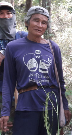 Almost 75 years after Minco's crash, another effort was made to locate his crash site. After several false starts, the search on the ground went to the wat at the named Mon Phaya Chae on Doi Farang, to the east of Lampang. A monk there, not familiar with local history, suggested contacting the chief of Ban Sai Tai, a village about 12 km north. That chief, Narin Fukom, นรินทร์ ฟูคำ,
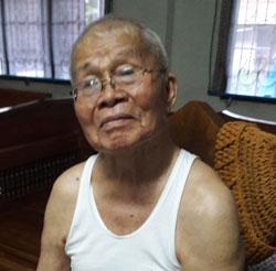 In Ban Mon Khao Kaeo, about 2 km WSW of Ban Sai Tai, Sukam Punang Kuan, aged 93, was about 19 at the time of the crash.
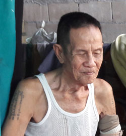 In Ban Ton Tong, the village next north, a Dtib Bpaseub, aged 11 at the time of the crash and now 85, went to the site with his older sister (now dead) immediately after the crash.